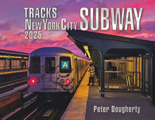
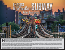
The 2025 Edition A-train Cover is now sold out. Thanks to all who bought their copy in the last year. The 2026 Edition will be available for pre-order in the first week of October.
What's New for 2025: MULTIPLE COVERS! There are so many excellent photos submitted for the photo contest every year, and many runners-up still deserve to grace these covers. For the first time, multiple front and rear covers are available for this year's book. This is an experiment, and if it's successful it will be repeated until the best of the previous contest submissions images have been exhausted. NOTE: The contents of the book are otherwise identical; it's just the cover images that are different. Also, the PDF file has all the cover images for the year.
On the inside, most of the system was redrawn from the ground up to be closer to geographic reality and to use more consistent formatting. Over 1000 hours of work went into the new maps, and doing this also allowed for the creation of a 4-page map index.
PDF edition users can link forward and backward to the index, from page to page, and from view to view. Since every print edition customer is entitled to a free PDF version, it was necessary to make that format a bit more usable. Note that the interactive features have only been tested in Adobe Reader and Foxit. They have not been tested in any other e-reader or PDF reading software, and the interactive features will not work on the Kindle platform, but the file will display just fine.
Station numbers are also new in 2025, along with a six-page index of stations at the back of the book, as well as web links to Wikipedia for every station, past and present. A few more interlocking closeups were added for 2025, and several pages were redrawn to use the new map format, most notably in south Brooklyn.
As always, the book depicts every track (with track numbers), every yard, every station, every chaining line and zero point, and and most (if not all) mainline diverging route home signals and their indications. The book also encompasses the latest capital plan items, signal changes and track/signal renewal projects. As with past editions, Grand Central, the Park Avenue tunnels, Penn Station, PATH, and the Staten Island Railway track maps are also included. Current fleet data and train service requirements have also been updated.
Note that the PDF version is intended strictly for on-screen viewing and is not printable.
Economy shipping of the printed book is available for customers in the USA. Delivery times may be longer than Priority Mail (up to 10 days is possible), but for shipping to NYC and environs it's usually about 3 days. Note: UPS shipping is uninsured. If you choose UPS and your package is damaged in transit it will not be replaced. This is a result of a change to UPS insurance terms that excludes shipments of poly bag merchandise.
Please add to cart and check out to see the exact shipping + tax charges.
I do not presently sell books to the United Kingom. Customers in Great Britain may order directly from Ron's Books. Please visit https://www.ronsbooks.com.
Likewise, EU customers please be advised that I will not collect and remit VAT under new European IOSS regulations. If you purchase from this site you may be charged VAT and customs fees by your country's government at import.
Hinweis für EU-Kunden. Ich werde keine Mehrwertsteuer gemäß den neuen europäischen IOSS-Vorschriften erheben und überweisen. Wenn Sie auf dieser Website einkaufen, werden Ihnen möglicherweise Mehrwertsteuer und Zollgebühren von der Regierung Ihres Landes bei der Einfuhr in Rechnung gestellt.


